Showing posts with label 1982. Show all posts

April 8 (1982, 2003, 2006)
Deep Snow on Moody Ridge; Rawhide Mine

4/8/82 Dawn. A clear, or at least partly so, day is on tap.

The storms finally stopped. In the high country, a near-record snowpack. Here, three feet of heavily consolidated snow are still on the ground. My ski track is packed, fast and icy.

I dug my Toyota out and was putting gas in it when Dana Pope drove up with two lady friends, Tina and Tina. We rented some skis in Colfax and they came out to my cabin for the night. the next day we skied out to Casa Loma. Last night I skied out to Casa Loma in the moonlight.

[Russell Towle's journal]


Date: Tue, 8 Apr 2003 08:34:52 -0800
To: Jay Shuttleworth
From: Russell Towle
Subject: Re: Rawhide Mine: Public access
Cc: NFT

Hi Jay Shuttleworth, you wrote,
>The Rawhide access has been a personal interest of mine for years. I first hiked into Rawhide from Sawtooth Ridge. We wanted to go to the structures, but my friend Steve Hunter (whom you met on our Canyon Creek and High Trail walk) told me of dogs and unfriendly caretakers.
>
>So, let's pursue this. From my experience with securing public right-of-way for the Iowa Hill trailhead of Stevens Trail, I think taking the personal approach is the best bet. I think a minimal "gentleman's agreement" would be our lowest goal, and at best, he could offer a legal right-of-way. I think approaching this person as a "fellow outdoorsman/naturalist" might offer the best results.
>
>Tell me what you think.
I agree, Jay; and I have met the owner, Harry Mayo, who is a high school teacher, as I recall, in the Sacramento area.

I want to emphasize that the old mine buildings along the North Fork of the North Fork, including the mine cookhouse and bunkhouse, and the powerhouse, are on TNF land; and so is the mine portal, the ball mill, and the mule barnlet. Taken altogether, these buildings and the associated equipment constitute a fascinating portrait of a working hard-rock gold mine in Placer County. The site might well be managed as an open-air museum of sorts. One of the problems is to dissuade visitors from walking off with artifacts.

Also, it is at least conceivable that the Rawhide Road could become part of a trans-Sierran trail, even a multi-use trail: from Casa Loma to Iron Point to Rawhide Mine to Sawtooth Ridge to Big Valley Bluff, to Big Valley to Pelham Flat to Four Horse Flat; then a problem, crossing upper Big Granite Creek; thence past Devils Peak on its north side, to Cascade Lakes, and on to Pahatsi Road. All except upper Big Granite Creek and the short reach of trail from Rawhide Mine would be on existing roads. I consider existing roads to be, at the least, reasonable candidates for multiple-use (including bikes) trails.

Finally, one of the private parcels just west of the Rawhide parcel, in the northeast part of Section 5, just barely touches the North Fork of the North Fork, downstream from the Rawhide. A new road has been bulldozed down to the river from the Rawhide road, and a cabin built beside the river. I wonder whether this road was made with a permit, or the cabin.

Ideally, Tahoe National Forest should look towards the purchase of these private parcels, including the one directly above Iron Point, also in Section 5, which will vie with the parcels out on Lovers Leap Road for the dishonor of ruining the viewshed, in this most remarkable part of the North Fork canyon.

Let's contact the Rawhide owner!

Cheers,

Russell Towle


Date: Tue, 8 Apr 2003 15:24:28 -0800
To: "Bill Slater"
From: Russell Towle
Subject: Re: Rawhide Mine: Public access
Cc: NFT

With respect to the Rawhide Mine, Bill Slater of Tahoe National Forest wrote:
>hey Russ. I discussed this w/David Michael. I have been working w/Mike
>Nevius (265-2592) on mine interpretation projects. He is associated with
>Northstar Mine in GV and various groups. He is currently setting up a mine
>interpretive project on BLM property. I have worked with Mike by providing
>the Heritage Resource/FS management aspects (evaluations) for these kinds
>of projects when they involve FS sites. He would be interested in the
>Rawhide mine.
>
>Bill Slater
>Archaeologist
>Nevada City RD
>Tahoe National Forest
Thanks Bill!

Since the mine and buildings are on TNF property, perhaps a formal inventory of heritage resources, is in order? Shouldn't we—I mean, you, TNF—document what is there? Photographs, GPS, lists of equipment and buildings?

Cheers,

Russell Towle


Date: Tue, 8 Apr 2003 18:57:57 -0800
To: "Bill Slater"
From: Russell Towle
Subject: Re: Rawhide Mine: Public access
Cc: NFT

Hi Bill, you wrote,
>Russ. When the FS plans a project involving specific acreage the need for
>a heritage resource inventory kicks in. A trails project involving Rawhide
>Mine would necessitate an inventory (and site recordation). If the site
>was threatened by adverse effects, as would be likely for the kinds of
>projects you envision, we would have to evaluate the site for the National
>Register and mitigate potential adverse effects if the site was found
>eligible. If adverse effects to a site are occurring as a result of
>unregulated public activities or erosion I can also check out the site and
>evaluate it.
So far as the trans-Sierran trail I mentioned: this is just an idea which has occurred to me as a possible (partial) trail alignment, for the Capitol-to-Capitol Trail proposed by the Placer County BOS, which, as laid out in their brochure, would very closely parallel to North Fork American river itself, from Auburn to the Sierra crest. I oppose the BOS alignment, but have been trying to imagine alternatives.

So don't take the trans-Sierran idea too seriously; I don't really want it myself.

However, Bill, there is an existing, historic trail on TNF lands there; it climbs from the North Fork of the North Fork to the crest of Sawtooth Ridge; it does not show on the TNF version of the Westville 7.5 minute quadrangle, but it does show on the usual USGS version of that map. Forget the trans-Sierran trail; I want to walk on the Rawhide-Sawtooth Trail, just as our grandfathers did, without anyone blocking my way with a gate or a "no trespassing" sign. I don't want to ride a motorcycle on the trail, I don't want to ride a bike on the trail. I want to walk on the trail.

Finally, you write "If adverse effects to a site are occurring as a result of
>unregulated public activities or erosion I can also check out the site and
>evaluate it."
The only discernible adverse effects are garbage strewn beside the river, suction dredging on the river, and use of buildings on TNF property for storage, of what, I do not know. Well, to attempt to block public use of a historic trail is also an "adverse effect." We are going to see if anything can be worked out with the owner.

Thanks much for your comments, Bill, they are helpful. Let's go in there and take a look!

Cheers,

Russell Towle

Pipevine Swallowtail, on vetch blossoms.
April 8, 2006


March 30 (1981, 1982, 1988, 2001, 2006)
Superman Point

3/30/81 clear skies and fresh powder up above. There I will soon be, on my skis, gazing about the wilderness.…”

[Russell Towle's journal]


3/30/82   Still snowing. About 2 feet on the ground now, and still snowing. The temperature never climbed above 30° here yesterday, in outrageous blizzard conditions. I'm developing a finely tuned sense of when I must move the Toyota or face entrapment. Moved it a necessary 50 yards at dawn yesterday; after a couple of hours of very heavy snowfall, had to take it the rest of the way out (to civilization-plowed roads) or else; so I did, my front bumper spraying snow the whole way.

This storm just won't let up. Snow falls more horizontally than otherwise. I tune into the NWS, and they opine that it ‘will arrive tonight’ ~ that should be quite a show.

I've been recovering, bit by bit [respiratory ailment]. Yesterday I was energetic enough to do my laundry, do a little skiing, dig my Toyota out of the snow about 10 times (I haven't put chains on yet and it rarely occurs to me to do so)—but that was a lot. When I reached the cabin, I ate and immediately spaced out ~ slept? ~ On the couch. Awoke at midnight, to bed; tired, but not feverish.

Then, arose this morning at 4:00 AM, got into heavy shoveling of snow to reach the outhouse; then fought a frantic battle with the frozen pipes, in pre-dawn pitch darkness powered by tiny flashlight.… lost. At dawn, snapped on my skis, delighted that I had so much energy, and skied out to the cable and back. Then repacked part of the track by skiing out and back again. But by then, my right lung hurt, and I was spitting bloody phlegm. Very scary to me. I was miserable, in fact. I rolled up in Oaxaca blanket and slept from 7:30 AM to 12:00. Now the lung hardly hurts at all. No blood anymore. If it would stop snowing I would go out skiing again. Actually, it's the wind.

Pipes still frozen. Having a fire is dangerous.”

[Russell Towle's journal]


3/30/88   afternoon of a faun, wind-blown crystal seething sharply cut and cool, sun so bright, I relinquish Seneca and Naturales Questiones and curious comments about comets, leave Suetonius and the exertions of Caesar, for my own grappling skirmishes with dead ceanothus, cleaning [their] corpses from the Grassy Knoll, peeking at peaks and a withering snowpack, observing a bold bracken fern breaking ground for its brethren, spinning lax fancies with a languid brain, about this or that project, a road of boulders here, a toolshed of boulders there, a clearing of further brush, of pines, of cedars, or maybe (shiver) just leave them well enough alone, block the wind, trap the sun; enshrine a thick and tangled copse so as to say, “Ecce! Once all was this!” ”

[Russell Towle's journal]


Date: Fri, 30 Mar 2001 08:54:16 -0800
To: North_Fork_Trails
From: Russell Towle
Subject: Adventure on the North Fork
X-Attachments: River_Trails.jpg:

Hi all,

Yesterday, Canyon O'Riley and I worked a bit on the road coming in to the Canyon Creek Trail at Potato Ravine Pass. We clipped about 100 manzanita and deerbrush branches and worked up a sweat. Then it was down the trail to the river, then upstream on the old river trail. Our objective: to see if anything like this old river trail reappeared farther up, especially, near a "particular ridge" projecting into Giant Gap from Moody Ridge, about a mile and a half upstream from Canyon Creek.

A map is attached, with contours at 100-foot intervals, bold contours every 500 feet, some contours labeled, and some points labeled. The Canyon Creek Trail is a yellow line, the two previously known reaches of river trail also yellow, the new reaches explored red, dashed where uncertain. The North Fork is a broad white line. The numbers on the sides are UTM coordinates in meters.


The river is flowing pretty high and clear and cold; a lot of snowmelt, with the warm weather.

The (first part of the) old river trail is in pretty decent shape, after the brush clearing project of a couple of months ago. After 1/2 to 3/4 mile it leads down to the river with a branch staying high, which branch, however, is overgrown and hard to follow. We followed the river instead, for I had the strongest image in my mind, that we could boulder-hop all the way up to the particular ridge. How wrong can a person be? We soon found ourselves stopped cold by cliffs plunging right into the roaring torrent, and had to climb high to pass them. A couple of times we descended to the river, expecting to be able to follow it, but, no. No, no, no. It became a kind of exercise in gymnastics, but no matter how cleverly we passed this or that obstacle, soon enough, there was another cliff. Finally, after a lot of up-and-down and huffing and puffing and getting all hot and bothered, we gave up on the river and found the trace of a high trail.

It soon headed directly into a dense thicket of bay laurel, interwoven with poison oak. The poison oak, by the way, seems to be doing well everywhere in that district. For a while we were stopped and then said, more or less, damn the torpedoes, and picked our way through the glistening poison leaves, on a line about 50 feet below the trail itself.

As if rewarded for our pluck, suddenly the trail became even more well-marked, and there could be no doubt of it being "the" high river trail. It even had some rock work and some switchbacks, and finally descended to the river just shy of the particular ridge. Here we found an abandoned kayak and some other gear. Probably the person will come back. We did not see a paddle.

By using our imagination we could perceive that yes, just as we had hoped, a trail continued high along the particular ridge. Rock-hopping over to its base, Canyon went up into an ocean of poppies and lupine and found the high trail. It was the real deal. On we went, reaching a trash-strewn miners camp from a decade or so ago. Then on just a mite farther, and we were rewarded with a fine view up the gorge, the North Fork churning along between two cliffs. Here there was no obvious continuation of the high trail, although, to be fair, if it had continued, it would have had to have climbed another one or two hundred feet at the least. We did not climb up to look for it. The cliffs here had suddenly gained much in magnitude and steepness. At the point we reached, we were atop a 100-foot perpendicular cliff beside a deep pool. It could be called Superman Point, because, with complete disregard for safety, one could easily jump into the pool. Unfortunately the pool looks to be only about six or eight feet deep below the cliff.

The afternoon was waning, the shadows growing long, so we started back out. Where Canyon had climbed straight up, we found the trail actually itself climbed up by a nice switchback a little ways farther downstream, moreover, the trail continued past the switchback. In a little ways it reached a little flat campsite from the days of '49. Beyond there it was horribly overgrown, so we dropped back down to the river, and picked the trail we came in on, near the kayak.

Incidentally, these old miners' camps are usually tucked within the shelter of live oaks. It is amazing, almost unsettling, how little shelter there is from the sun down there, especially near the river. There are no alders or willows or cottonwoods at all to break the force of the sun. It is just rock on rock, cliff on cliff, a hundred thousand flowers on the slopes above, and the roaring, dancing, dangerous river. And the sun. Sun on sun.

For a long ways this trail is in remarkably good shape, though often overgrown. Then a critical region is reached where things become less certain. This is shown as a red dashed line on the map. There are some big blades of rock and one branch of the trail runs high to pass these. I mean, fully 400 feet above the river. Another branch runs low, but is faint. We took the high road and soon found ourselves blocked up severely by a big area of blooming buckbrush. This was, however, familiar to us, from our efforts of a month ago to find a continuation of the high trail. We adopted the same strategies to pass the brush, and soon enough found a certain ravine where, having crossed to the west side, we stopped at the "miners' tool cache," where we did some cleanup. I had brought a garbage bag for just this purpose, and gathered old batteries, a flashlight, all kinds of miscellaneous plastic, and four five-gallon plastic buckets. These had been in enough sun over however many years to have partially disintegrated, so we picked up all the scattered pieces and jammed the intact ones together, packed it all up and continued west. There remains a sleeping bag and some clothes and a foam mattress. And a bunch of tools, including two sluice boxes.

This was the last of the uncertain part of the high trail. It traverses a grove of canyon live oaks well above the river, then hits another ravine, where one must descend two hundred feet to reach the "main" old river trail. Soon we reached Canyon Creek.

The sun set as we came up the Canyon Creek Trail. We were moving slowly, it had been a real thrasher, an incredible workout. Apparently I am notorious for such adventures. The unwary accompany me on a hike. They imagine it like this: a broad, flat, shady trail, possibly downhill the entire way, and downhill on the way back as well. Without warning, they face a nightmare of cliffs and gorges and poison oak and rattlesnakes.

These old river trails are severely influenced by the topography. A cliff or a rock blade may force the trail up a hundred feet or more. A ravine may force it down fifty, then up fifty on the far side. The steeper the terrain, the bigger the rock blades, the higher the trail is above the river. We found ourselves 400 feet above the river at times. I would say with all the various ups and downs of our little 1-and-1/2-mile jaunt up the river from Canyon Creek, we added at least 1500 feet, maybe 2000 feet of vertical climb, to the rather mild 1500 feet from Potato Ravine Pass down to the river on the Canyon Creek Trail. So it was a 3000- to 3500-foot day.

The flowers are really spectacular. The poison oak is viciously robust. The sun is hot, the river is cold, the rocks are steep. Truly the North Fork American is a wonderful river. We got back to the Dutch Flat exit and saw that the waxing crescent moon was centered between two planets.


March 30, 2006
A common plant of the shady forest floor in the North Fork canyon is White-veined Wintergreen. Russ altered this photo highlighting leaf edges, and named the file "abstracted pyrola".

View a CalPhotos database image of a blooming un-abstracted White-veined Wintergreen:
http://calphotos.berkeley.edu/imgs/512x768/0000_0000/1109/1006.jpeg


February 10 (1982, 2003, 2008)
Snow Flakes in the Sun ~ CCT Photos and a River Scramble into Giant Gap ~ Thrusting Shoo Fly

2/10/82   Soon after dawn. Skis stand in the sun, awaiting the re-mounting of the heel locators with sanded bottoms and epoxy in the screw holes.

Dave Nelson and I went skiing yesterday, up to Rowton and the meadows in the headwaters of Onion Creek. He did quite well. We were blessed by a beautiful day, with two inches of fresh powder on a firm base. Partly cloudy skies dropped finely shaped snowflakes on us while the sun shone.

I saw a bird dive into a hole in the snow up on top of the ridge near Dave's place. It had been dancing.”

[Russell Towle's journal]


Date: Mon, 10 Feb 2003
To: NorthForkTrails
From: Russell Towle
Subject: Giant Gap by way of Canyon Creek

Hi all,

I met Larry Hillberg, who has been gradually cleaning up the mess out on the Stevens Trail, at ten in the morning, and we snuck into the Gold Run Diggings and drove to the head of the Canyon Creek Trail in Potato Ravine. Larry says that there are probably twenty more loads to be carried out from the Stevens Trail site.

This was Larry's first visit to Canyon Creek. We stopped to admire the great tunnel of the Gold Run Ditch & Mining Co. (1873), crossed the bridge, saved the side trail to the Blasted Digger for later, noted Brewer's Rock Cress and Biscuit Root in bloom at Gorge Point, skipped the Six-Inch Trail to the Inner Gorge, but took High Terraces Trail and then the spur up to the Big Waterfall. We saw many California Milkmaids and some Rue Anemone in bloom. The white racing pigeons were not in evidence.

I remember a friend of mine, Ron LaLande, brought a passel of racing pigeons up here in the mid-1970s, and all but one of them were killed by falcons and bird hawks in fairly short order. The one survivor, a female named Jethro, used to fly beside Ron as he rode his little motorcycle miles in to Dutch Flat. Perhaps these pigeons of the Big Waterfall have been discovered by hawks or falcons.

Returning down the spur trail, we dropped down to the Terraces, where the miners who tended the sluice boxes in Canyon Creek in the 1870s had their principal camp, to find a young man camping there. His name is Peter Fortune, and his camp was neat, and a civil engineering textbook has open beside him on the lawn-like terrace. We chatted with him for a while. It developed that he had discovered Canyon Creek on my web site. I mentioned that only that morning I had thought about taking down the Canyon Creek page, since too many people seem to be discovering it. However, young Peter Fortune is just the kind of person I like to see in there. He is a friend of Gene Markley, the famous gorge-scrambler and master of obscure mining trails in the American River basin, and Peter and his friends consult with Gene and then explore accordingly. He has done the Royal Gorge, Giant Gap, the gorge between Euchre Bar and Green Valley, and other parts of the North Fork. In fact, it was Peter who did the trail work Catherine and Ron Gould and I observed in the east end of Green Valley, a few weeks ago.

Peter mentioned what I had also recently heard from Ron, that the side trail to Green Valley from the Euchre Bar Trail has been flagged in red; Peter adds that the flagging extends to the summit of East Knoll. This worries me, as a private parcel extends to the top of East Knoll from the river, and I have heard the inquiries were made to Tahoe National Forest by someone owning property in Green Valley, who wished to bulldoze a road down there. TNF made some efforts a few years ago to purchase the private inholdings in Green Valley but failed.

Larry and I left Peter to his studies, and took Lower Terraces Trail back to the main trail and quickly reached the river. The day was surpassingly sunny and clear. After a short break, we decided to explore the upriver trail. This trail passes a rather nasty cliff only a couple hundred yards east of Canyon Creek. From this first part of the upriver trail one can see, alternately, the Pinnacles on the right, and Lovers Leap on the left, as one looks up into Giant Gap.


The trail climbs and then plunges up and down in an annoying fashion, passing rocky spurs and dipping in and out of gullies. We saw a pair of kayakers ahead, scouting some rapids. The trail drops slowly back to near river level and then climbs slightly to level out through a grove of Canyon Live Oaks, around half a mile upstream from Canyon Creek. At the east end of the grove the trail becomes faint and an old miner's camping terrace is seen, with garbage strewn all over the slopes by squatters, perhaps ten years ago.

Here one reaches a gully and a problematic part of the upriver trail. East of the gully is a difficult patch of brush with much thorny Buckbrush. At the lower level, around one hundred feet above the river, where we hit the gully, there is no clearly-defined continuation of the trail. At higher and then still higher levels, there are two trails leading out of the gully to the east, but both enter the brush-patch, which is nearly impassable. Larry and I just stayed low until past the brush and then switched back and forth up grassy slopes between rock crags until we reached the upriver trail again, here around three or four hundred feet above the river.

This trail probably dates back to the Gold Rush, and then likely was used by Chinese miners working the river in the later 1850s and 1860s. Wherever the canyon narrows into a gorge it is forced to follow a higher line. It was very open and sunny and we saw Houndstongue in full bloom.

Now nearly a mile upstream from Canyon Creek, and so high above the river, we enjoyed very fine views of the remarkable cliffs and pinnacles of Giant Gap. In places we lost the trail, but always rediscovered it, and finally it descended back to river level, at a sharp bend in the river.

An unnamed spur from Moody Ridge forces the river into an even sharper bend just upstream. One rambles along over boulders near river level, and then climbs up a short distance to regain the upriver trail, as it runs along the base of the spur ridge. As it approaches the sharper bend, another old camping terrace, with another mess of squatter's garbage, is passed. Then, in a welter of poison oak, one can climb to some rocky cliff-tops with a view up the river east of the spur ridge. Although the canyon has been fairly gorge-like in the two miles upstream from Canyon Creek, here it becomes so extremely cliffy that whatever slender thread of trail which may have once existed, would have followed a very high line above river level.

The sun was lowering as we began our retreat back down the trail. When we reached the Brush Patch near the gully, we did some crawling and found the higher of the two trail lines into the gully. Since we were fully 400 feet above the river, and since we agreed that elevation is a precious thing, we decided to angle up and to the west and strike the ridge dividing Canyon Creek from the North Fork at the Blasted Digger Overlook. This turned out to be somewhat harder than we had imagined, but it was interesting to be on such wild cliffy slopes. There are a couple of gullies which contain great fields of angular talus.

As we slowly zigged and zagged up and to the west past crag and shrub a falcon zoomed by, heading west. It had a lot of white on its head, and I am not sure what species it was.

Finally we gained the ridge, only a hundred yards from the Blasted Digger. I had hoped to stop and rest there and enjoy the fine view, but the sun had set for that point, though still gilding the high cliffs across the canyon, and a chill was in the air. We took the trail back to Canyon Creek and arrived at Potato Ravine in another fifteen or twenty minutes, very tired and scratched, but pleased to have visited such an inaccessible and beautiful part of the canyon.

Such was a day on the North Fork American.

Cheers,

Russell Towle


Thrusting Shoo Fly
[North Fork Trails blogpost, February 10, 2008:
http://northforktrails.blogspot.com/2008/02/thrusting-shoo-fly.html ]
On YouTube, at
http://www.youtube.com/watch?v=J3KryrAGkBo

is an animation of a flight up the American River Canyon, using the USGS Digital Elevation Model 30-meter data set, and merging a couple dozen DEM quadrangles to build a landscape spanning Colfax on the west, the Sierra Crest on the east, the San Juan Ridge and Grouse Ridge to the north, and the Middle Fork of the American on the south. The virtual camera follows an almost due east heading from west of Rollins Lake, crossing over Lovers Leap and Green Valley, and flying on up the canyon into the Royal Gorge. The animation finishes with the virtual camera making an orbit of 360 degrees around Snow Mountain.

Thrusting Shoo Fly: on my iMac I can set the screensaver to loop through any folder of images in my iPhoto library. It so happens that right now it loops through a folder of some of my favorite photographs in the North Fork. Here is Giant Gap, from the west, and now from the east; or the 500-foot waterfall in New York Canyon, or Big Valley Bluff at dawn, as seen from the North Fork, a couple miles up the canyon.

And so on. It's not hard to take beautiful photographs in such a beautiful place.

It happens that one of these special photographs shows what I call Bluff Camp, an old mining camp immediately adjacent to the river, set on a cliff-bounded strath terrace bearing a fine grove of Canyon Live Oaks. From the North Fork American River Trail, connecting Sailor Canyon to Mumford Bar, a side trail leads one down a hundred yards, or so, to Bluff Camp. I have camped there many a time. It is half a mile or so east of Tadpole Canyon, and directly below Big Valley Bluff, rising in ragged cliffs all of 3500', across the river to the north.

And the photograph was taken from a point upstream from Bluff Camp; so one sees a part of the encircling cliffs, and a flat area—the strath terrace—perhaps thirty feet above river level. (A "strath terrace" is a glacio-fluvial landform associated with glacial outwash sediments which once occupied the terrace itself; and it was these very sediments which planed down the bedrock, to make the terrace).

It caught my eye, the other day, the Bluff Camp photo, as it filled the screen; I could see an abrupt change in the bedrock, right at the upstream end of the strath terrace. Slowly, dimly, I realized I was seeing a thrust fault. Two disparate bodies of rock had been juxtaposed by faulting.

The bedrock for miles up and down the canyon is composed of metasediments of the early-Paleozoic "Shoo Fly Complex," the oldest rocks in all the Sierra. I have a wonderfully precise geologic map of this part of the North Fork canyon, made by David S. Harwood et. al. of the USGS, in the early 1990s. Harwood shows many thrust faults in the Shoo Fly Complex near Big Valley Bluff, Sugar Pine Point, and New York Canyon. The faults sometimes bring big blocks of chert, hundreds of yards in extent, or more, into contact with slates and other types of rock in the Shoo Fly Complex.

By the way, it is called a "Complex" because it is composed of many distinct formations, spanning many millions of years in time, but all very old. Harwood describes and names four such formations in this particular area. His map does not show the Bluff Camp Thrust, which is probably a sensible choice, for it is likely not very long or large as thrust faults go, and if he were to put every such minor thrust fault on his map, well, there would be room for precious little else.

It has long been considered that the great mashing-together, the epochal juxtaposition of the disparate Sierran metamorphic rocks alongside one another, took place around 145 million years ago, in what was named the "Nevadan Orogeny" (an "orogeny" is a mountain-building). It was this Nevadan Orogeny which acted to rotate all these disparate bodies of metamorphic rock almost 90 degrees to the east, so that what were once flat-lying beds are now almost vertical, or even slightly overturned. And it is considered that the "penetrative fabric" of these disparate metamorphic rocks is mainly due to the Nevadan Orogeny. The compressive and shearing forces which imparted the fabric were fairly well parallel with the current, almost-vertical orientation of the beds. Very likely it all had to do with continental accretion, at a time when Pacific ocean floor was being actively subducted beneath the continental margin, moving from west to east, but also plunging steeply down.

However, in many of these different metamorphic rock formations, whether they be down by Auburn or up at Big Valley Bluff, an experienced eye can detect at least two different episodes of deformation, each leaving its footprint, or imposing its fabric, upon the rocks. There is the later Nevadan Orogeny; and at Bluff Camp, there is a thrust fault vastly older than the Nevadan Orogeny. That is to say, the Shoo Fly was already well-deformed, well-sliced and diced by thrust faults, long before the Nevadan Orogeny.

And Harwood discusses all this in the twelve-page essay which accompanies his map. There are a couple of typographical errors in this essay which play the very devil in understanding the thing.

It is not at all easy to learn to recognize these different rock types. That this is chert, and that is quartzite, may not be discernible except under a microscope. To develop a simple portrait of the bedrock geology, one can read what was written about it a century and more ago. At that time the focus was upon the broad outlines, not the higgley-piggley details. And for a time, the following usage had currency, for instance, in the articles by C.J. Brown of Dutch Flat, published in the Mining & Scientific Press, in 1875.

Brown divides the metamorphic rocks as follows: the Western Slate, the Middle Slate, and the Eastern Slate. Between the Middle Slate and the Eastern Slate, he identifies the long narrow serpentine belt we now name for its associated Melones Fault Zone.

Hence his Eastern Slate corresponds to the Shoo Fly Complex, and those other Paleozoic and Mesozoic rocks which lie on top of the Shoo Fly, and therefore, to the east (the whole shebang, be it remembered, rotating 90 degrees to the east during the Nevadan Orogeny).

Brown's Middle Slate corresponds to the Calaveras Complex, another complex of formations, but late-Paleozoic in age, and he correctly identifies the rock of Giant Gap as metavolcanic—in fact, Brown declares it to be metabasalt; and his Western Slate corresponds to all those metamorphic rocks west of Cape Horn, in which there are several distinct formations, often dominated by metavolcanic rock, but containing some metasediments, too.

So, if we wish to blur our focus and appreciate the broader outlines of local bedrock geology, we might give C.J. Brown's Western/Middle/Serpentine/Eastern model a try.


February 1 (1978, 1979, 1982)
Echoes of Spring-To-Be

2/1/78  wednesday morning, dense fog fills the canyon, an unusual event in that it has not rained for weeks now. a cold air ~ polar air ~ must have moved in last night, for the thermometer registered a 30° low, about ten or twelve degrees below the minimum recorded for the past week. in spite of that, my water line did not freeze, and only a very light frost shows around the cabin. actually, yesterday afternoon i noticed a sharp decline in temperature, and attributed it to a change in my metabolism. then upon further consideration i decided colder air must have moved in. the thermometer bears me out. and the fog is probably a direct result of the colder air. there has been no fog in the canyon since the rains. it is burning off now. today was scheduled for a group hike, probably down into giant gap from bogus point.”

[Russell Towle's journal]


2/1/79 ~ morning. snowing again. my headache is gone, but my body is a little achey still. it is finally thursday and i get to see cynthia again, how nice. maybe we'll spend the weekend here ~ and i'm out of firewood, and tim's saw is out of order, so great, no firewood, a cold cabin, no money, i've let everything slide but it's ok, everything is sliding perfectly into a position so that all nine of beethoven's symphonies will thrill the very bones of giant gap, with aretha franklin songs lining the edges, and a few beatles tunes outcropping here and there, peruvian flute concertos transmitting through the hooves of deer into the earth and back out through the buds of manzanita flowers-to-be ~ it will be very nice! sonatas for cello and piano by bach will mate with django reinhardt tunes while clouds twist and unravel the gasping energy of tibetan saints in perfect concordance. let's see. anything else? oh yes! throbbing conga drums will gently but inexorably incline the earth towards spring, echoes of spring-to-be will cause our feet to twitch and our sexual organs to hang loose and warm in anticipation. a lone trumpet will split the scented air with lines of melody etched in gold upon the pink pyramid of Giant Gap. who plays the trumpet, perched on the impossible spire of Mobut? who stands and throws melody lines for eagles to glide on, golden lariats entwining nostalgia with clarity with power with grace with all the yearning of all God's children? who is that spirit-singer with the radiant countenance?

... laughing.”

[Russell Towle's journal]


2/1/82 ... Now, Schubert, morning sun stabbing its warmth through the cabin. I need to cut more firewood. Want to work on my hot water system. Realign the water-jacket in the stove and cut out the draft tube in the tank.

The snow on the road coming in is patchy, and the skiing is threatened. I can drive in to the cable now. Shoveled some snow into the thin spots yesterday. I'd guess it's a losing battle. Perversely, in places the snow on the road is over two feet deep and well-consolidated. In places it is inches deep. In places it's gone.

Someone walked in my ski tracks yesterday, my track that I was so proud of because it was so perfect and fast. Now it's a mess.

[...]

[Russell Towle's journal]


January 26 (1978, 1982, 1999)
The Generosity of Existence

1/26/78  [...]  yesterday ron, neil, gary, and i hiked down to the river again. we left directly from ron's house and descended the ridge below casa loma to the large knoll at the head of green valley. dropping on down to an old trail about a hundred feet above the river, we encountered some fine exposures of marble with interesting plications. we followed the trail up the river, eventually reaching the euchre bar bridge and the confluence of the north fork and the n. fk. of the n. fk. some fine cascades along the river. ron and i continued up the north fork a little ways and returned via the iron point-euchre bar trail. a glorious sunset. today is nice and sunny.”


1/26/82    Early morning. Cigarette and coffee. A mysterious tone, like a deeply-pitched marimba key or the tones arrived at by rubbing the edge of a champagne glass, but very deep ~ repeated about once every two seconds, of about 1/2 to 1 second duration, appearing to originate outside the cabin. So early, so dark, so rainy, that I won't bestir myself to track it down; indeed I luxuriate in the generosity of an existence that provides so many mysteries, that I can waste opportunities to unravel their tangles and reveal the knots that bind them to the fabric of existence.

It's early. Dark. The two rains wash the cabin ~ the one original rain, with its barrages of small drops; and the derivative rain falling from the oak branches high above the cabin, with its larger, louder drops typing over the page of my roof, secret messages from the ether, if I had ears to hear.

If this had been snow, I would have weeks on end of skiing in and out of my cabin to look forward to. As it is, the past few days have been warm, and the snow had been melting rapidly; the rain should knock it down even faster. Moody Ridge road is rapidly deteriorating on the grade next to Hartze. A soft trench has been churned down into the roadbed below the snow; it would be lovely if the first quarter mile of Moody Ridge road were paved. It would be lovely if the Green Valley Trail was forgotten by the General Public.

Strong winds, no hint of dawn. New messages composed and typed with reckless abandon on the roof. Extremely rapid key-work; only a demonic energy could manage such outbursts.

Blue-green algae very happy in the sunshine, click together into mandalas, big grin on their faces.

Now sleet, goddamn it, tapping its code on the big window, little clinking clicks or clicking clinks, and it ain't supposed to be ~ I want rain, rain, rain, rain to erase the snow below the 4200‘contour. For a while. I want to bring my wheelbarrow back from the McClungs.

[...]

~ Night... hmmm; how to put it? That it was a stormy day, rain and sleet splattering down in cool steadiness, the big brushes of pine needles bent and waving in the wind, singing their mournful tunes. That I skied out in the Slush and the Sleet and got Pretty Wet before I reached my Toyota. Slurped on out Moody Ridge road and sped in to D.F. to find my mailbox empty yet another day...”


1/26/99  [...]  I have also been corresponding with TNF about the Towle Brothers Railroad and the possibilities of making a trail along its course; I have shown Bill Slater, one of their archaeologists, over the section from Bear River up to Lowell Hill Ridge. Perhaps something will come of this.

I continue to work on developing a trail connecting Lovers Leap to the Gold Run Diggings and Garrett Road, and have done a little trail work at the Lovers Leap end, and quite a lot at the Gold Run Diggings end. Recently I have been doing a lot of exploring in search of an old trail leading to Bogus Point from Canyon Creek, which I hypothesize once existed, and the main problem has been that there are many old trails here and there on that slope. On my last trip, just before the flu struck, I found an extremely promising trail forking off from the main Canyon Creek Trail near the first waterfall vista point.

[Russell Towle's journal]


Snow on Moody Ridge, January 26, 2002


January 25 (1977, 1982, 2006)
Pristine Visions, and Less-Pristine Realities

1/25/77   [...]  the past few days, images of the granite domes of the yosemite area have been crowding in the edges of my mind, past all the sawdust and people and music that wander there. i see a swell of glittering granite rising out of the forest, and breathe the crystalline air at its summit. i feel that shiver of reckless glee and expoloration tug at me, urging me to swiftly make for the summit of one of the domes, and to wander around its base... well, i hope i can take a month or so this summer.”

[Russell Towle's journal]


1/25/82   Morning, a bit before dawn on Monday. The snow is still a foot deep around my cabin, and a couple feet up in the meadow. I've been parking out at Casa Loma road and skiing in. Moody Ridge road is a horrible mess.”

[Russell Towle's journal]


A New Old Trail (Stevens Trail)
["North Fork Trails" blog post, January 25, 2006:
http://northforktrails.blogspot.com/2006/01/new-old-trail.html ]
Tuesday morning Ron Gould and I drove into Burnt Flat east of Colfax, and took a tour down the Stevens Trail. It was my first time, since the wildfire of 2004.

The day was sunny and clear, verging upon warm.

The Stevens Trail connected Colfax to Iowa Hill, crossing the North Fork American on a bridge near Secret Ravine. The bridge is long gone, but the Stevens is one of the most popular trails in all Placer County. From the Colfax exit on I-80 one proceeds east on the frontage road, Canyon Way, to the parking area. It is about four miles to the bridge site; and there is an idea at large, I hear, to build some kind of bridge there, again.

Red shows the route followed; I-80 is at far upper left.
(Click to enlarge.)
One can also walk the Stevens from Iowa Hill, west.

All this part of the North Fork is a Wild & Scenic River.

Ron Gould, on the Stevens Trail, 2006.
We aimed to explore an old trail beyond Secret Ravine, on the north canyon wall but low to the river, being about 200 feet above. I know I have this trail on at least one of my old maps, but an external hard disk has gone silent, and I can't find it. The Stevens Trail is the fifty-sixth trail described in the abortive 1953 Placer County Trails Ordinance, and its description mirrors an error in map-making itself, an error propagated across more than one map, namely, the mislabeling of Secret Ravine as Robbers Ravine.

I had made a few explorations beyond Secret Ravine in years past, and picked up traces of the old trail, without ever reaching the "good part" so plainly visible from the Stevens Trail on the southern, Iowa Hill side of the river. A maze of game trails on steep terrain had made me scout high and low and every which way, finding only scattered remnants of dry-laid stone walls, at what seemed the right elevation, around 200 feet above the river.

View west from the Stevens Trail, Colfax-Iowa Hill Rd. bridge in  the distance.
(Click to enlarge.)
It was interesting to see the effects of the 2004 wildfire. It had burned hot near Robbers Ravine, with its pretty waterfalls, and nearly all the trees had been killed, conifers and live oaks alike. But the root systems of the angiosperms were vigorously stump-sprouting, especially notable in the Bay Laurel, with clumps of a dozen or more sprouts spearing six feet high already.

Crossing Robbers Ravine—one is tempted to ascribe the name to the botched 1881 train robbery at Cape Horn, high on the cliffs directly above, but a check of the diary of Steven Allen Curry, a CPRR surveyor, reveals it already had its name in 1865—we broke out onto the sunny open cliffs, with fine views down the canyon to Mineral Bar and the Iowa Hill Road.

To my horror, a large house has appeared on a ridge crest above Mineral Bar, a house which, like too many others, at Lovers Leap and Bogus Point and Iron Point and Lime Point and above Ponderosa Way, should never, ever, ever have been built. Sensible societies do not sacrifice the best of their scenic heritage to the whims of a few egomaniacs.

A ‘vulture house’, above Mineral Bar, mars
the wild ambiance of the canyon.
This is just what noted educator David Starr Jordan meant, when he suggested a "hilltop ordinance" was needed in Auburn, to protect the scenery. He made the suggestion around 1904!

But this is Placer County, a name fated to suffer anagramation into the word, “parcel,” so that I often bitterly ask myself and The World, during my interminable internal private rants, "So, which is it going to be? Placer County, or Parcel County?"

And unfortunately, the answer always is, "Parcel County." Supposedly our Republican Supervisors have such a strong belief in private property, they will sacrifice any trail, any swimming hole, any breathtaking canyon view, to the short-term interests of any individual. The sanctity of these private property rights is such that a kind of religion, based, one expects, upon a foundation of shopping malls and subdivisions, holds our Supervisors in its loving thrall.

Oddly, quite strangely, when I pause to think of the thing, these same Republicans cease crowing about the inviolable sanctity of private property, just about the time one asks how legal title to Placer County lands was obtained from its original inhabitants, the Southern Maidu, and the Washoe.

For no legal title was ever obtained, away back when; a few Euro-Californians with consciences made certain that treaties were negotiated with each tribe, exchanging large reservations for a quit claim to their title on all remaining lands. The Indians duly made their marks, and the generals and bigwigs signed the treaties too, and off to Congress they were sent, in 1852.

It was the last chance to put a decent face upon the theft of California from the Indians.

But when the treaties reached our Senate, in far-away Washington, strange to say—who could have guessed such a thing might happen?—the treaties, with their scratchy little marks and squiggles, made by Chief Weimar and so many others, were placed in a sealed secret archive, not to be unlocked for fifty years.

My friend Jay Shuttleworth, who represents the very best spirit of volunteerism in his long-sustained efforts on behalf of the Stevens Trail, my poor poor friend—how it will hurt, when he sees this new house on the hill. Here is scenery celebrated, admired, gasped over, by every person who ever walked that trail. And now Lord Smith has crowned himself King of the Hill and no person who walks the good old Stevens Trail can walk it, now, without paying a perverse kind of homage to this Lord Smith: you avert your eyes.

North Fork American River, below Cape Horn
It is just like going down the old trail to Green Valley, or walking around in Green Valley: one learns not to raise one's head the wrong way, not to lift one's eyes to Moody Ridge, for the Vulture Houses on Lovers Leap Road will strike one dead in one's tracks.

Well, not quite dead. What is hurt is one's faith in human nature, and one's hope that the best and most beautiful places we love, will remain for our children and their children, to love as well. To be caught in the Medusa glare of the Vulture Houses, as they lord it over the Giant Gap of Thomas Moran, and force themselves upon that quintessential scene of all Placer County scenery, is to have one's living hoping trusting heart frozen, into an ugly little rock smelling of ashes.

But this is Parcel County.

Again and again the horrible new house reappeared, as we followed the winding Stevens Trail south and east up the American River Canyon.

We were quite struck by the record the recent flood event left; patches of grey sand twenty feet above normal river level, driftwood stuck on cliffs, willows and alders flailed prostrate and skinned of their bark, under the boiling storm of sand and mud and cobbles and boulders. It was very impressive and I recommend a hike on the Stevens if only for that reason, to see the marks of the rarely high water of a few weeks past.

 A few flowers were in early bloom here and there, notably, Houndstongue, with its pretty forget-me-not, blue and white blossoms.

At Secret Ravine, about three miles in from where we left Ron's truck, we found a faint fog hovering over the shadowed creek, and frost on the fresh flood sands. There were some thousands upon thousands of ladybugs clinging to tree trunks and so on, in nearly frozen, motionless masses of shiny red hemispheres.

The 2004 wildfire had not crossed Secret Ravine, at least, here at river level.

Soon enough we were repeating the same old exercise: following various roughly level game trails across steep slopes, alert for signs of lopping, or old rock work, or anything to show the line of the trail. Eventually, in somewhat more than a quarter-mile, I should say, we reached the intact portion of the trail. Suddenly we saw signs of lopping, and guessed our compatriots, Evan Jones and Co., had been at work, by the looks of it, two or three years ago. It was quite easy going on a nearly level line in the full sun with incredible views and all I can say is that it is one of the very nicest trails in the North Fork—yet—yet it is reduced to a ghost of a ghost of a trail for that first quarter-mile east of Secret Ravine.

We fully expected to find and follow the main line of the trail back to Secret, on our return, but such was not at all the case. This trail is very seriously disrupted, over a fairly long distance.

There are indications that this old trail—I shall call it, here, the Meta Secret Trail (for it leads up the canyon, beyond Secret Ravine)—was a mining ditch, originally. It is often very suspiciously level. If true, this may supply the answer as to why the trail is so faint, near Secret Ravine itself: that whole section might have been a wooden flume, thus, no very large bench cut was needed, just a few bits of rock wall here and there to bolster the flume.

Then, let a few wildfires come through, and burn the wooden flumes into oblivion, and one has a somewhat discontinuous trail.

That's the good old Meta Secret Trail.

Across the river one sees the Stevens Trail, with huge stone walls, crossing a mossy cliff. It is quite a lovely view.
The mossy, Iowa Hill side of the Stevens Trail, a north-facing slope.
Unfortunately another Vulture House came into view, away west in the fire area; clearly the firefighters had made noble and successful efforts to save it, despite its perilous position on the canyon rim. Good for the Vulture Family, bad for the North Fork and the rest of us. As a result of the fire and the firefighting, all screening vegetation was gone, and it is just as though a brand new house had been plopped down on the canyon rim.

I became nauseous thinking about the two Vulture Houses lording it over the North Fork and the Stevens Trail.

Wooly Sunflower 
Eriophyllum lanatum)


Aster Family (Asteraceae)

Also across the river I observed a large bluff-like mass of glacial outwash, forming a terrace about 100 feet high. The whole face looked fresh and raw and recently eroded, and clearly, the North Fork had chewed at the base of the steep gravel bluff, during the recent flood event. However, I was almost certain that that raw steep face had been left by mining, either ground sluicing or hydraulicing, a century and some ago. It is even possible that the Meta Secret Trail began as the very ditch which served that particular mine; in which case, a flume would have crossed the river.

An old tunnel, possibly dating to the Gold Rush itself, had been exposed by the flood. It was driven into the glacial outwash low down towards the bedrock underneath. Probably many tunnels had been driven into the base of that bluff. They have since collapsed or been buried by cave-ins around their entrances. The coarse gold was found on the bedrock at the bases of such glacial outwash terraces, more commonly known as "bars" or "gravel bars."

A calm stretch of the North Fork American River
(Click to enlarge)
But these gravel bars are artifacts of the high flows and high sediment loads of the glacial periods; current flood events do little more than nick the bases of such terraces.

We reached an unnamed ravine, with a pretty stream, crossed, and found an old mining ditch trail on the far side, at a slightly lower level. The Meta Secret continued!

After a time, the Meta Secret dropped down to river level, and we saw sunshine just upstream, and worked our ways up to the place, at a sharp bend on the river. We had lunch and, scouting the area, found some miners' camps with much in the way of garbage strewn around, five-gallon buckets and sleeping bags and tarps and just plain garbage. I grabbed an aluminum frying pan and returned to the river.

Wresting clumps of moss from boulders near the water, I washed them into my frying pan and panned the sediments down to black sand. Swirling, some respectable flakes of gold appeared. So Ron and I washed a few more clumps of moss into the pan and found, I don't know, about fifty or a hundred "colors" of gold, among them, some pieces almost big enough to just reach in and pick up. So, it was a little exciting to see all that gold. Probably at least a dollar's worth!

The winter sun, never high, was clearly lowering, we were over a mile east of Secret Ravine, and had another three miles beyond that, to reach the truck. It was time to go, past time, really, and I ended up forty minutes late, picking up my kids at their school bus stop, in Alta.

Camera looks east, upcanyon, between Robbers Ravine and Secret Ravine, directly below Cape Horn.
On our return we followed a higher line at first, following a faint trail climbing west from some ancient cabin terraces. At times this tiny thread of a trail seemed to disappear, but we held the course and found large cairns of slaty slabs where it crossed a rocky spur, and then other ducks and cairns along the way, and found ourselves back on the main Meta Secret just where it had seemed to drop down to river level, on our way in, a couple hours before. So there is actually a fork, at that point, and a steep climb to the left, as one is going in, will make the safest route on to that sunny bend, where Ron and I found so very much gold.

But this left-hand upper trail is extremely hard to see, from the fork. That is, the fork does not by any means look like a fork. It is just the spot, it seems, where the trail suddenly drops to river level.

This last bit of high trail, and the ancient cabin terraces near Gold Strike Bend, may date to the Gold Rush itself, and likely were also in use later, by the Chinese, in the 1860s.

Such was another nice day in the North Fork. I learned some new lessons, too, about how to avert my eyes properly, while walking the Stevens Trail. With a little practice, I may one day walk the Stevens Trail, and find it as beautiful as I did, way back in 2004.

Perhaps if I cup my hands around my eyes, to reduce my field of view?


Links: 

“Cape Horn” information, and a clickable map with photos is here:
http://cprr.org/Museum/Sierra_Grade_8-2003/Cape_Horn/index.html


Scroll down that page to find a 360° panorama of the western portion of this area taken from the level of the railroad tracks in the middle of Cape Horn.

The entire newswpaper account (Sacramento Record-Union) of the aborted train robbery at Cape Horn can  be read here:

http://chroniclingamerica.loc.gov/lccn/sn82014381/1881-09-02/ed-1/seq-3/ 

June 10 (1982, 2004, 2005)
Double Baptism ~ Tadpole Point

6/10/82   hot summer weather. ginseng ravine: old mine tunnels, fear of snakes, rhododendrons in bloom.

thunderheads near the sierra crest. afternoon shadows lengthen.”

[Russell Towle's journal]


Visit to Canyon Creek; the HOUT
[North Fork Trails blogpost, June 10, 2004:
http://northforktrails.blogspot.com/2004/06/visit-to-canyon-creek-hout.html]
Yesterday I met Catherine O'Riley for a hike on our beloved Canyon Creek Trail. After the thunderstorms and rain of the day before, Wednesday dawned cool under a general overcast, but by ten in the morning the clouds had parted into fair-weather cumulus, of which there were many, but all in all giving much more sun than shadow. It was in fact the perfect spring day.

We were delayed for a time while I learned the bad news about the family Subaru from Randy of Dutch Flat Motors. A rather modest dent would require some thousands to repair; and worse, Randy was not equipped to do the work. Randy is a jovial man, on the large side, now favoring hoggish Harley Davidsons, but once upon a time a racing bicyclist, who competed in the 1972 Olympics, at Munich.

We used our usual secret road into the Diggings and drove a mile or so to the trailhead in Potato Ravine. The Gold Run Diggings is a vast complex of hydraulic mines, once an irregular tiling of dozens of discrete claims, but over time some 800 acres fell into the ownership of one James Stewart, a friend of Jack London and Franklin Delano Roosevelt; except that a number of worked-out claims in the southern part of the Diggings had lapsed back into public lands, now managed by the BLM. For years many of us have urged the BLM to try to purchase ever so much of the 800 acres as possible; for a number of important trails, historical sites, and paleobotanical resources span the irregular boundary between private and public lands, there to the south.

In recognition of this most-remarkable part of the Diggings, when Congress designated the North Fork American a Wild & Scenic River, in 1978, they created a special "Gold Run Addition" to the W&SR corridor, which extends fully a mile north of the river, well into the Diggings. The BLM was directed to acquire the private inholdings within this special area; but the owners were not willing sellers, and nothing could be done.

The 800 acres has been for sale for the last few years. Time for the BLM and act, swiftly, decisively! But no. There is no money. Land trades have become difficult to execute. And now we learn that a credible offer has been received on the 800 acres, by someone desiring a "private reserve," and the owners have made a counter-offer. I have been afraid to call the one owner with whom I am acquainted, for fear that disaster has already struck, and the sale is in escrow.

We set off down the trail, winding out of Potato Ravine on the Indiana Hill Ditch (which, in testimony recorded during the 1881 trial, State of California vs. the Gold Run Ditch & Mining Company, we learn was completed on September 13, 1852), and then dropping away south and east to closely parallel Canyon Creek. For a time we were on BLM lands, then crossing onto a part of the 800 acres, which runs right down to the North Fork itself. We made rapid progress down the trail, across the little bridge, stopping briefly at the first large waterfall, and enjoying the late-season wildflowers.

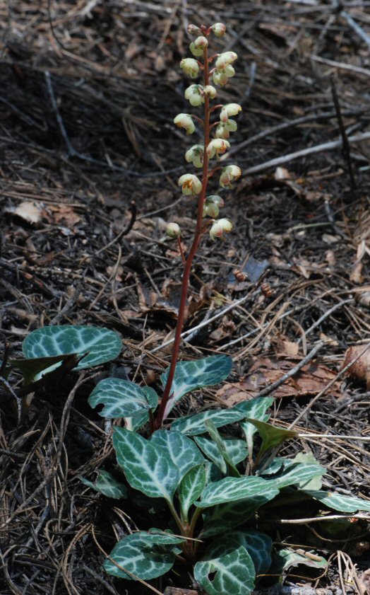
Notable among these were the Two-Lobed Clarkia, Harvest Brodiaea, a species of Lotus, a species of Madia, and the very last of the Bush Monkeyflower. The bloom this warm and dry spring has been pushed forward nearly a month, so many species which would still make a fine display, have already shed their flowers and set seed.

We passed the Rock Slide and were on the steep slopes above the Big Waterfall when a family of Canyon Wrens caught our eye. They were foraging for insects among a jumble of rocks, not singing at all, but busily poking into every tiny cave and crevice. These birds are a rusty brown with a creamy breast, pert wren trails, and a curved beak. Their wild lilting descending sequence of notes is a classic ornament on cliffs and in canyons, in the Sierra and elsewhere.

Then to our amazement one of the mysterious white racing pigeons which had taken up residence near the Big Waterfall, winter-before-last, soared into view, disappearing towards the waterfall, then circling back and sweeping away south into the main North Fork.

We decided to break away east on the HOUT (High Old Upriver Trail), a strangely level thread of a path which can be followed miles up the canyon into the heart of Giant Gap. It is a relict of the Giant Gap Survey, a scheme of a hundred years past to divert waters of the North Fork for San Francisco's water supply. The schemers put men at work to rough in the line of the proposed canal, and they dutifully blasted out narrow ledges from the cliffs, and drove a couple of tunnels through the flaring rock spurs below Lovers Leap.

The clouds had gradually increased in size and their shadows drifted across the cliffs all around us. The views east, of Lovers Leap and the Pinnacles, which opened occasionally to our admiring eyes, were made even more dramatic and lovely by the fluffy clouds. These clouds seemed to swell higher before our eyes, and for most of the day, we felt a kind of restless excitement, at the prospect that a fully-blown thunderstorm might develop. To which we only said, bring it on!

At a certain point, nearly a mile east from the CCT, a fork is reached, where one can either hew to the line of the Survey (the HOUT), or drop away east and down to the North Fork, just shy of massive Big West Spur, which might be more esthetically named Castle Spur, in honor of a fine large conical mass of bare rock adorning its summit, a thousand feet above the river. The river makes a funny kind of square turn around the base of this spur ridge before turning again to bear nearly west to Canyon Creek. A large expanse of large boulders occupies the outside of this last big bend in the river; all the boulders look to derive from the steep slopes in the immediate area, being various types of metavolcanic rock of the late-Paleozoic Calaveras Complex.

We took a long lunch break here amid the boulders, which at the base of the little trail contain some level pockets of sand. The river was sparkling clear, moderately cold, and moving along quite nicely. Across from us and a ways upstream, a gigantic boulder reared up ten or fifteen feet above the water, and a little clump of moss caught my eye. I pointed it out to Catherine, remarking it looked much like what I had thought to be an extraordinary Water Ouzel nest, on a mid-river boulder, up in the Royal Gorge. These ouzels a like large grey wrens and dive right into the river, foraging for insects etc. underwater. They zoom up and down the river itself, a foot or so above the water, and have a rippling, chattering, random song which hardly sounds like a song at all. John Muir's favorite bird. And they nest, almost always, in the spray of waterfalls, making a hollow ball of moss and such, which a downward-sloping entrance, often impossible to see unless the birds are actually going in our out.

That's a water ouzel's nest. But I had seen that one rarely strange nest in the Royal Gorge, like some kind of miniature wigwam, perched atop a boulder. Here, perhaps, another, and I might have to stop thinking of such an ouzel nest as so rare or unusual. We went to investigate, hopping from boulder to boulder to boulder to a last boulder almost at mid-stream, only forty or fifty feet from the Big Boulder. The truth could not be denied. It was an ouzel nest, the rock near the entrance streaked with white excrement. The entrance was plain to see, opening to the west, downstream. The nest was about six feet above the water, on a ledge.

Swallows were zooming around, but there were no ouzels visiting the nest. The young must have been already fledged, several weeks ago perhaps. After a time we started back.

I placed my right foot on a polished little boss of stone and with my usual casual expertise made a leap to the next boulder. Then, with all the grace of a ballet dancer, I slipped and turned, in slow motion as it seemed, and made what amounted to a swan dive right into the North Fork. I remember seeing a boulder underwater as my face slammed down, and darting my hands down to break my fall. Boulders to either side bruised my hips as I plunged fully and completely into the river, but I kept my face safe. It was complete submersion, a total soaking from head to toe.

Standing up, the bruises almost incapacitated me; it felt as though I had pulled the muscles; I could really barely stand, and made a slow and awkward business of climbing out of the water.

After a minute I could move again, and used much more caution than usual in hopping back to the main boulder-field and our sand hollow.

I had a long-sleeved shirt to change into and just wore my blue jeans dry. Actually, they're still drying, right outside on my porch.

After a time we decided to follow an old miners' trail up the river to the first square corner of the base of Big West Spur. As we hopped along, I tested my bruises and kept up a decent pace and felt reassured that I was, after all, OK. Then a holler was heard. I looked back; no Catherine. What; a rattlesnake? A strange flower, a rare frog? What could make her holler like that? I retreated a dozen yards and she came in view, dripping water.

It was a double baptism, then, into the North Fork; except, Catherine had not equalled my own total submersion, only managing a modest three-quarters. We can now justly claim admission into the ranks of those hardy souls who swim the North Fork in spring.

So we squished along in our wet shoes and reached our square corner, a ways up above the river on a cliff, admiring the narrow gorge there, and the deep pools, and remembering a few years past when we had scrambled and swum Giant Gap, with Chris Schiller, and had finally left the swimming behind, at just this point, just this sunny bar of rounded boulders, a hundred feet below us.

Eventually it was time to start back, and we took it pretty easy, as is best after all, reaching Catherine's truck around six p.m.

Such was another fine day on the North Fork.


Tadpole Point
[North Fork Trails blogpost, June 10, 2005:
http://northforktrails.blogspot.com/2005/06/tadpole-point.html ]
Thursday morning the rain slacked off and the sun peeked through, so it was deemed time to drive up the Foresthill Road and, by hook or by crook, hike north to the cliffs above the Point of Beginning, or Point of Ending, of the Iowa Hill Canal. I do not know how to name these cliffs. They are on the divide between Tadpole Canyon, on the west, and New York Canyon, on the east, and stand a little over 3000 feet above the North Fork.

Tadpole Point?

Ron and Catherine & I met and made the twisting odyssey across the North Fork on Ponderosa Road. Turning left, we followed up the Foresthill Divide past the Beacroft Trail and Ford Point to where snow still blocks the road, just shy of Canada Hill, at around 6400' elevation. We put on gaiters and packs and tromped off over patchy snow to the north, following a road which only occasionally could be seen. We were hugging the west rim of New York Canyon.

Our long drive upcountry had carried us out of the sunshine into clouds and light rain showers. To the east we could see the Royal Gorge and Wabena Point, appearing and disappearing amid swirling fog, with shafts of sunlight lighting up a patch of cliff or forest here and there. Only the lower one or two thousand feet of Snow Mountain was visible, below the cloud-deck. Everything pointed to continued clearing, more and more sunshine, and less and less clouds.

At times we walked through pure stands of Red Fir, with bright yellow-green Staghorn Lichen coating their trunks down to about six or ten feet above the ground; this would seem to be the average depth of the snow-pack, in such groves. Perhaps the lower parts of their trunks are subjected to scouring by wind-blown snow, and the lichen can't stand up to the punishment.

At other times we ranged closer to the steeps of New York Canyon, where brush and Sugar and Jeffrey pines were more dominant.

We began to see thin fog gathering over the little snowfields in the deep woods; wherever some shelter from wind allowed time for the moist air-mass to be chilled by the snow, it was plunged below the dew point and began condensing into fog.

So there was fog and cloud above, below, and all around us. The snow made for easy walking, being dense and fairly firm. There was much dirt and pollen and woody debris and the red bloom of algae on the snowfields.

A hike of about two miles brought us to the cliffs. We were in the Barney Cavanaugh Ridge Formation of the early-Paleozoic Shoo Fly Complex metasediments. Here the North Fork glacier was rather more than 3000 feet deep, and there were some nice exposures of glaciated slate and sandstone and chert.

The USGS's David Harwood mapped this area in 1993. He defined and described the Barney Cavanaugh Ridge Formation as follows:

"Devonian? to Ordivician?—Purple, green and gray slate interbedded with white-weathering, greenish-gray, parallel- and cross-laminated, fine-grained, quartz sandstone and quartz-rich siltstone; contains chaotic zones as thick as several hundred meters of disrupted quartz sandstone and siltstone in purple slate matrix; large blocks of gray ribbon chert, quartzite, and quartz-granule conglomerate occur in chaotic zones. Maximum thickness 500 meters."

At the cliffs, we were immediately amazed by the appearance of the big waterfall in lower Big Valley Canyon; from this new vantage we could see the top of the falls, but not the bottom, and tho difficult to estimate, I would not be surprised were it to measure 150 feet in height, maybe a little more.


This waterfall has to rank along with the biggest and best in all the North Fork.

But perhaps more startling were the other falls which came into view on the west wall of Big Valley, farther up its canyon. There was one thin stripe of whitewater which must have been hundreds of feet high. And higher, in the west fork of Big Valley, we saw another large waterfall, spreading fan-like over a steep cliff. The upper 500 feet of 3500-foot Big Valley Bluff was hidden in clouds.

Fog and clouds boiled everywhere. The river was visible directly below us, and here and there down the canyon streaks of silver showed it again and again. Away west the sun was shining. It was a spectacle of great beauty, constantly changing. Some 600 feet below, at the base of these cliffs, we could see little patches of the Iowa Hill Canal. We climbed out onto narrow rocky points, wet and slippery with their mosses and lichens. The chartreuse rock lichen was much in evidence. And while roaming east along the cliff-tops, we found some old gold mines, where quartz veins had been stoped out at the surface, in one place leaving a strange channel, cut twenty feet deep and four to six feet wide, in the gray ribbon chert.


To my dismay, roads had been cut down to these cliff-tops at several places. Checking my 1976 map of the North Fork American Roadless Area, I saw that the line had been drawn right at the cliff-tops; so the roads likely date back to the 1960s. They ought to be permanently closed well above the cliffs.

I had hoped that we could work our way east to a view of the New York Canyon 500-foot waterfall, but while at the Tadpole Point cliffs, a ray of sunshine hit the brushfields below and west, where we had been stopped a week ago, walking east on the Iowa Hill Canal from Beacroft Pass. Fog instantly boiled up and wafted past us. Charming! Mystic!


But it grew thicker and thicker until we were utterly encased and could scarcely see a hundred yards. Some invisible metereological boundary had been crossed, and rather than lifting and clearing, the clouds lowered, it began raining lightly, and our canyon views were almost lost completely.

So, although we did work along farther east, we were not as inspired as we might have been, and thought perhaps a bit more of the warmth of the car, than of crashing down the unknown brushfields in search of some presumed gap which would allow a view of the NYC falls. We were within a quarter-mile of what would have been The Spot, so far as I could read the Duncan Peak quadrangle, a spot near the center of Section 33; but we were all a little wet and a little cold and had a good two miles ahead of us, to get back to the car.

 So in a fit of prudence we turned south and soon struck one of the pesky roads. This we followed higher and higher over deeper and deeper snow. At a certain point we found a Jeep Wagoneer which had been abandoned last fall. It had slid off the road, perhaps in a bit of snow. All kinds of gear was inside. The back window was broken out. Despite this, everything inside looked fairly dry and intact. Soon, I think, a bear will take care of that little anomaly.

Following the road, it eventually proved to be the Wrong Way, so we struck up through the Red Fir forest a few hundred yards east and hit our smaller road of our ingress, a few hours earlier. We were near a series of clearcuts on Tahoe National Forest lands which drape below the canyon rim of the main western tributary to the West Fork of New York Canyon. These clearcuts look fairly old—twenty years?—but show close to zero regeneration.

I would like to see a complete end to such clearcuts, and, again, a motorized vehicle closure enacted on the lower, more northern parts of the various roads which approach the Tadpole Point cliffs.

I don't want to put too fine a point on it: these cliffs form one of the greatest of all the amazing scenic overlooks in the North Fork canyon.

We slogged along over snow for a good while and reached the car about eight p.m., and were soon fogging up the windows with our wet clothes, and slowly zooming southwest. We stopped at Ford Point to drive down the ridge for a look at the Secret Canyon ditch, a tributary to the Iowa Hill Canal. We found that a logging road had been cut directly into the line of the ditch. There seemed to be some prospect that the ditch continued intact, going up Secret Canyon, but more exploration is needed.

All these old mining ditches were used as trails in the olden days; they often were critical parts of the whole complex of trails. So soon as they fell out of use, and wildfires consumed the wooden flumes which once spanned cliffy sections and small gorges, their use as trails was much reduced.

It seems obvious to me that many of these old mining ditches could once again become foot trails. Could, and should. Whether the berms could tolerate equestrian or mountain-bike use would have to be decided on a case-by-case basis.

While in the Ford Point area we were treated to a glory of reds and golds and pinks as the sun set into swirling clouds and fog. It was totally awesome.

Such was another visit to the great canyon, or as it was often named in the 19th century, The Great American Canyon.